Mareeba Shire Council has issued a neighbourhood survey to all residents in Mareeba’s ‘Anzac Avenue Local Traffic Area Precinct’ to seek community input into the traffic and transport issues impacting the area.
The Anzac Avenue Precinct is bound by the Barron River to the west, Hastie Road to the north and Kennedy Highway to the south.
“Council has commenced a consultation process under the ‘Local Area Traffic Management’ framework to allow us to conduct targeted community engagement to identify and resolve traffic management issues in specific areas,” Mayor Angela Toppin explained.
“There are nine identified LATM precincts in Mareeba, and the Anzac Avenue Precinct has been chosen as the first area to undertake consultation. This will be treated as a pilot project to test the engagement methods and process for the model.”
“The Anzac Avenue Precinct was chosen due to the significant traffic volumes travelling along Anzac Avenue, from the highway and the significant development in recent years on the Eastern side of Mareeba.”
Residents in the selected neighbourhood will receive a survey at their homes this week and have the option to complete the hard copy and drop it to Council’s Customer Service Centre or Library, return it in the post; or to complete the survey online.
Survey responses are due by Friday, 23 September 2022 with the results to be presented to the residents of the Anzac Avenue Precinct at a Neighbourhood Meeting on Wednesday, 12 October 2022 at 5:30pm at the Cedric Davies Community Hub.
The survey also seeks nominations from interested community members living in the Anzac Avenue Precinct to be a part of a new Local Resident Traffic Working Group. This group will be facilitated by Council and is likely to meet two times after the initial neighbourhood meeting on Wednesday, 12 October.
The results of the survey and meetings will be considered, along with traffic data to identify priority projects to be undertaken.
“Council is currently collecting traffic count data from across the Anzac Avenue Precinct to assist with analysing and understanding the feedback from residents,” the Mayor concluded.
Take a look at the Local Area Traffic Management (LATM) Precincts below, or download a copy here: Local Area Traffic Management (LATM) Precincts .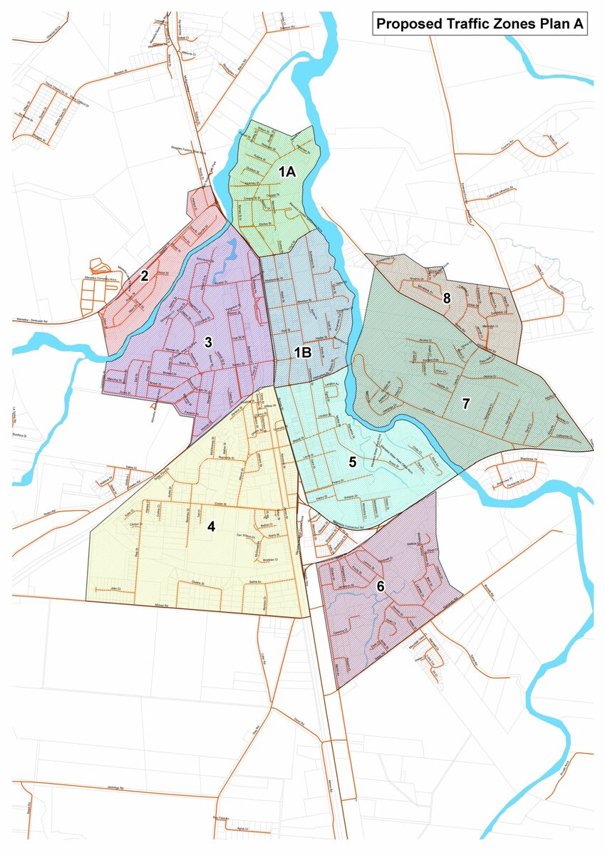
Q: What is an LATM?
A: The ‘Local Area Traffic Management ‘ model is where Council identifies precincts within a community where targeted community engagement is conducted to identify and resolve traffic and transport issues in specific areas.
Q: Where is the Anzac Avenue Precinct?
A: The Anzac Avenue Precinct is bound by the Barron River to the west, Hastie Road to the north and Kennedy Highway to the south.
Q: Where are the other precincts in Mareeba?
A: The other Precincts have been identified to represent either similar population sizes, or to encapsulate transport corridors and routes.
Q: Why was the Anzac Avenue Precinct chosen as the pilot?
A: The Anzac Avenue Precinct has been chosen as the first area to undertake consultation and will be treated as a pilot project to test the engagement methods and process for the model.
The Anzac Avenue Precinct was chosen due to the significant traffic volumes travelling along Anzac Avenue, from the highway and the significant development in recent years on the Eastern side of Mareeba.
Q: What will Council do with the results from the survey?
A: The results of the survey, consultation and Local Resident Traffic Working Group discussions will be considered, along with traffic data, to identify priority projects.
Q: What is the Local Resident Traffic Working Group?
A: A volunteer Local Resident Traffic Working Group will be appointed in the Anzac Avenue Precinct and will include up to 5 community residents who live in the precinct.
The residents will be geographically spread across the Precinct and must be able to attend up to 2 meetings between October and December.
The Local Resident Traffic Working Group will assist Council with reviewing the results of the survey and other data sources to prioritise transport and traffic projects to address resident concerns.
This model recognises that the residents who live in an area know the issues and opportunities best and will ensure that the prioritised projects reflect the local community’s needs.
Q: What other data will be considered to identify priority projects?
A: Traffic data and previous customer requests received by Council will be considered to identify priority projects within an overall traffic management plan for the precinct.
Council is currently collecting traffic count data from across the Anzac Avenue Precinct to assist with analysing and understanding the feedback from residents.
Anzac Avenue Precinct – Zone 7
The final neighbourhood meeting was held on Wednesday, 14 December 2022 where the Local Working Group’s priorities were presented.
A copy of the presentation is available HERE.
Previous Neighbourhood Meetings
A meeting was held on Wednesday, 12 October 2022. A copy of the presentation is available HERE.